Drone Inspection Services
GET YOUR PROJECT STARTED
Rise Above
With Chandler Drone Services
Commercial Roofing
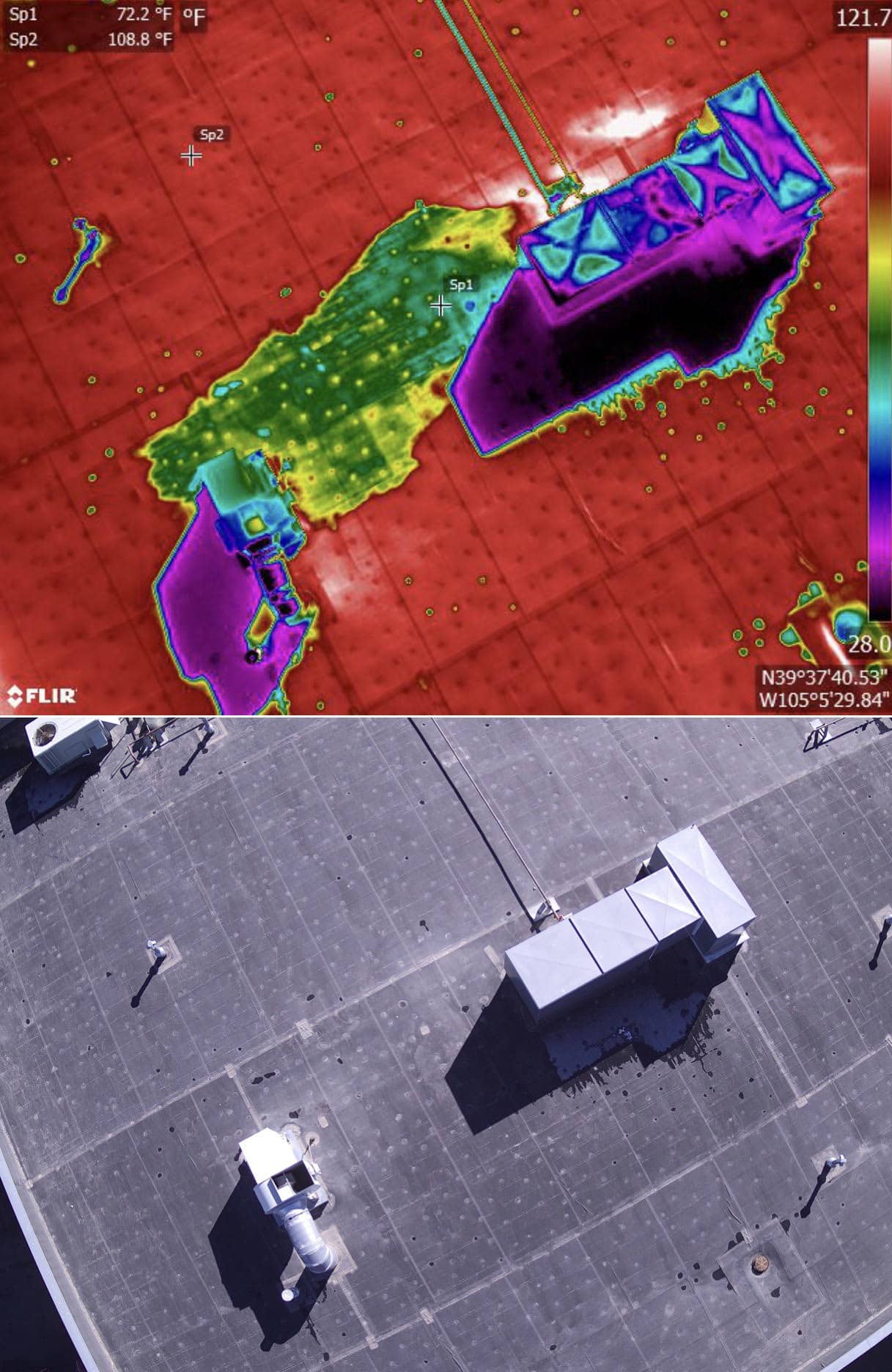
Moisture Mapping
We have teams of commercial drone operators across the US who can capture data on any building in the country. That data is then sent back to our headquarters to be imported into our proprietary software, which produces a model that we can use to show you, down to the inch, where trapped moisture is hiding in a roofing system.
This technology is incredible at providing clarity to your clients, data to help with insurance claims, and more importantly, peace of mind, knowing you have all of the moisture in a roof outlined and accounted for. Re-roofing? No problem. Coating? Let’s get a model made so we can verify you won’t roof over wet insulation.
It’s cheap, and accurate, and we can perform the scans just about anywhere, with no need to physically climb on the roof. Use the contact form above and we’d love to chat with you and put your mind at ease.
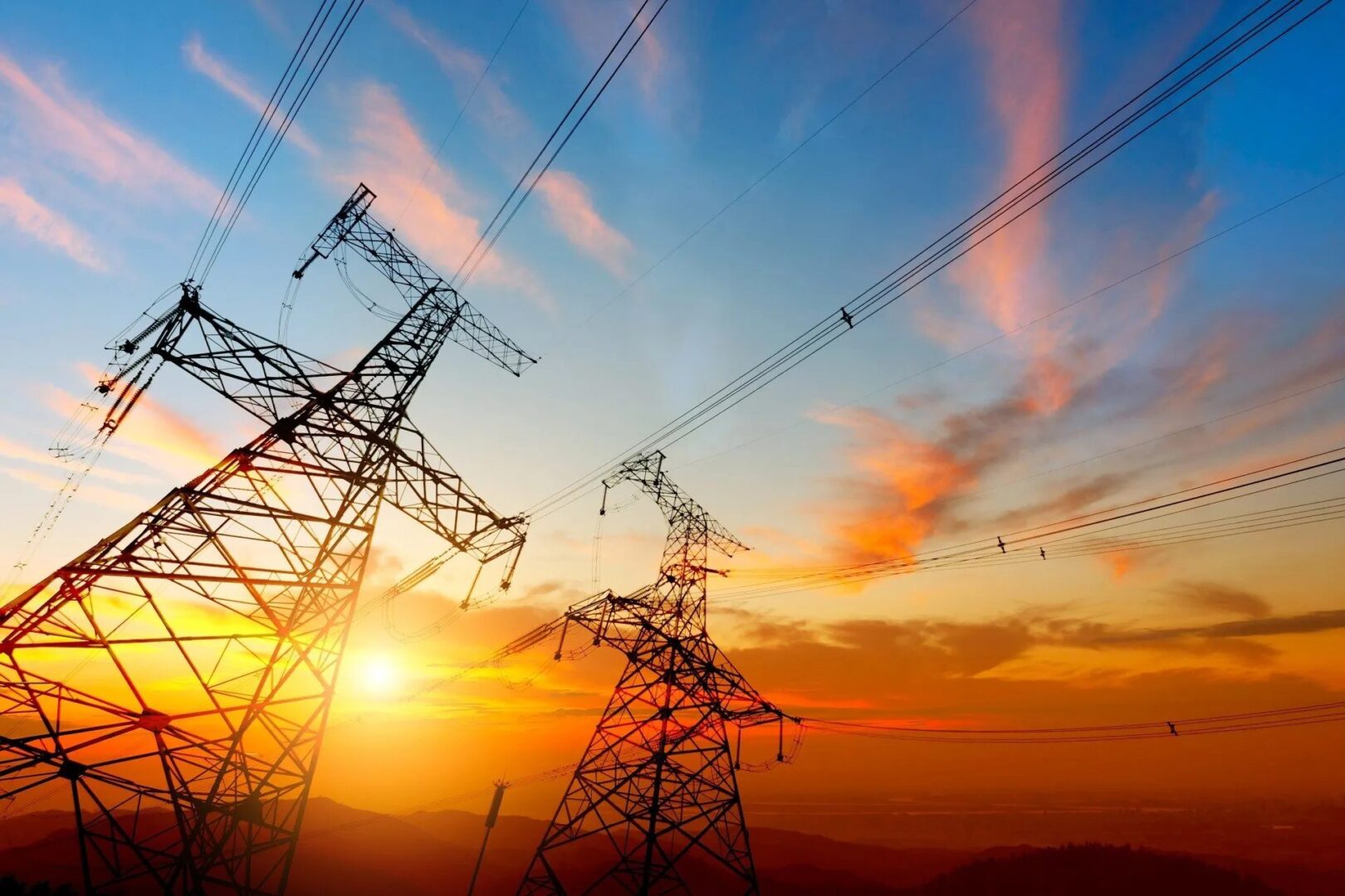
Utility and Substation Inspections
Electrical Utilities benefit from adding a drone program to their existing maintenance plan for their distribution and transmission towers. Our drone teams can inspect hundreds of poles a day, in any terrain. Our analysis includes both standard imaging, and thermal imaging, providing a dual layer of data for our analysis.
We work with highly skilled linemen to analyze the images, and provide a report outlining all of the poles in organized severity ratings, along with a breakdown of each of the found issues. This methodology allows for tremendous savings as crews can now be focused on critical issues before they occur, and catastrophic events can be mitigated through cheaper, and faster inspections across the entire system.
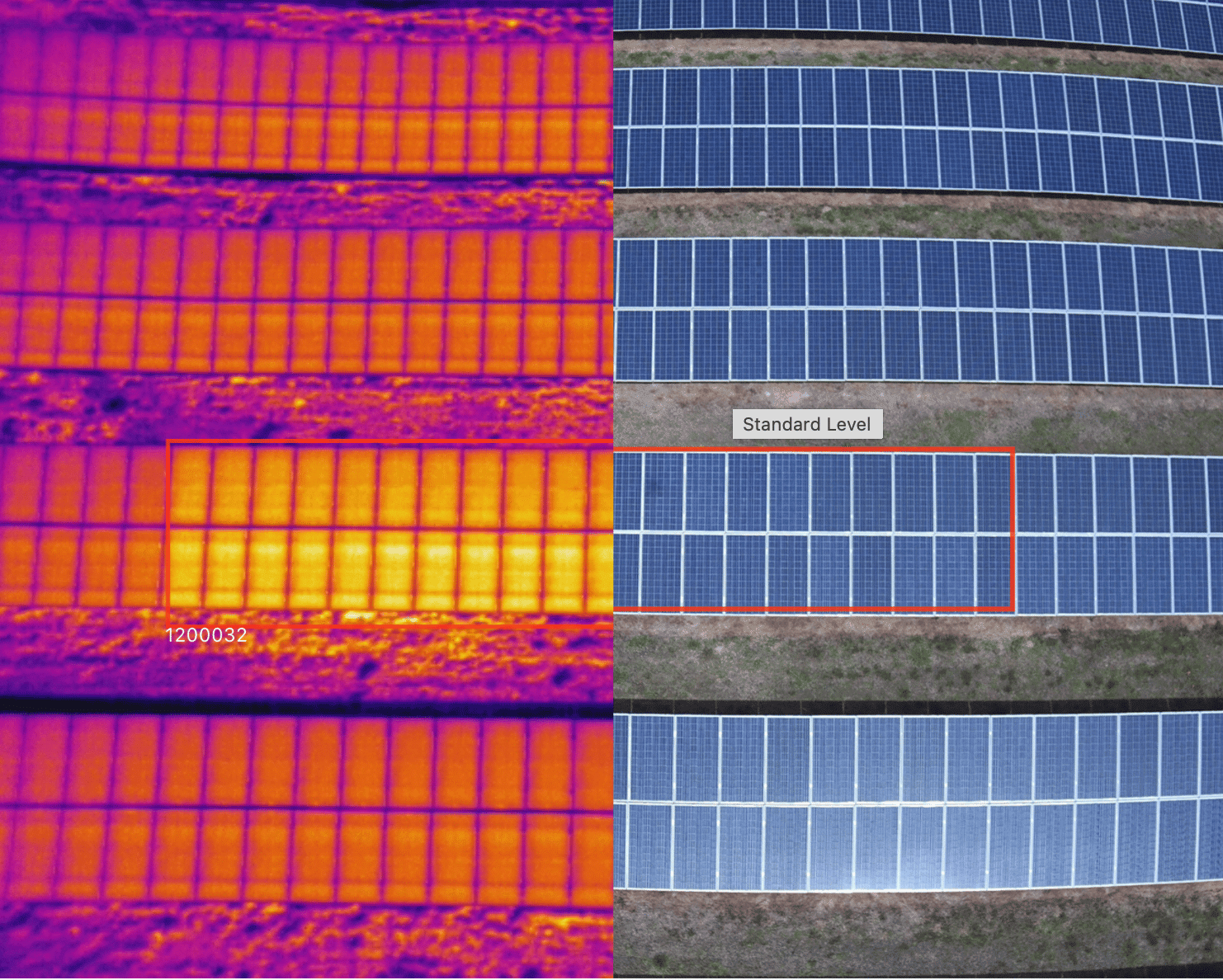
Solar Field Inspections
Chandler Companies is proud to work hand in hand with one of America’s leading thermal engineers. We staff a crew of analysts, which similar to our roof inspections, report back any and all anomalies, down to an individual cell in a panel. Cost analysis and expected loss of revenue is also included, outlining the real time effect damage identified is having on a system as a whole.
Inspections take hours, not weeks, and can be done year round. Our reports are engineering grade, and actionable decisions can be made immediately after the report is delivered, saving owners precious time and manpower. Get a digital twin of your solar sites, aerial thermal inspections, data normalization, serial number mapping, warranty claim features, equipment records, mobile tools and more — all powered by our industry-leading data model. Standardize and compare data across installations, increase performance, reduce risk and lift ROI.
Property Marketing
Use drone services to soar above the competition
Chandler’s drone inspection services are beneficial to the industrial sector, utility companies, commercial property owners, and municipalities. Drones can also be used to create aerial tours that are helpful for property marketing. Discover how our drones will contribute to your business’s success today.
FAQs
Drone aerial inspection is an innovative method of utilizing unmanned aerial vehicles (drones) to conduct detailed inspections of structures, assets, and areas from an aerial perspective. With unparalleled access and precision, inspectors can safely gather highly-detailed visual data from a unique vantage point, providing a rich analysis that would otherwise be impossible.
Expert drone pilots operate drones equipped with high-resolution cameras and sensors to capture detailed images and collect precise data from specific areas. This data is processed, analyzed, and converted into actionable insights and reports.
Drones eliminate the need for manual inspections in hazardous or hard-to-reach areas, reducing the risks to human inspectors. They can also cover large areas quickly and efficiently, reducing inspection time and costs. You also get high-resolution imagery for more precise analysis and identification of potential issues.
Drones are ideal in utility inspections because they can inspect power lines, wind turbines, solar farms, pipelines, and other utility infrastructure. By capturing high-quality images, drones offer a safer and more efficient approach to monitoring these assets. They can also detect hidden defects, corrosion, or other issues requiring immediate attention, allowing for timely maintenance and repairs.
Drone inspection services can benefit a wide range of industries, including:
- Energy and utilities
- Construction and infrastructure
- Oil and gas
- Agriculture
- Telecommunications
- Insurance and risk assessment
- Environmental monitoring
Unmanned aerial vehicle (UAV) inspections are a highly cost-effective alternative to traditional methods. Drones can survey areas much faster than manual inspections, reducing labor costs. In addition, using drones is a simple yet successful way to access hazards without costly equipment.
Drone aerial inspections utilize various equipment, including:
- Drones: Equipped with high-resolution cameras, thermal imaging sensors, LiDAR, or other specialized sensors.
- Ground Control Stations: Devices used by operators to control and monitor the drone's flight.
- Data Processing Software: Tools used to process, analyze, and visualize the collected data.
- Communication Systems: Enables real-time transmission of data and live video feeds.
Yes, drone inspections require compliance with various regulations and permits, which differ across states. To initiate inspections, drone operators must acquire relevant certifications, licenses, and permits from aviation authorities. They must also ensure compliance with airspace restrictions, privacy laws, and local regulations.
However, an experienced drone inspection company can handle all compliance requirements and obtain necessary permits and authorizations for a smooth operation.
Drone inspections offer a variety of important information, including detailed visual inspection data, infrared imagery to detect heat signatures, analysis of structural integrity, and the ability to measure distances between objects.
Drone inspections provide highly accurate aerial imaging with the use of GPS technology. The images captured during a drone inspection will be incredibly detailed and allow for precise measurements that could not be possible without drones. Additionally, drones with sophisticated mapping software can accurately map out an entire area in minutes.
Testimonials
